Management of Data and Surveys

Management of Data Collection Surveys - An integral part of our hydraulic modelling experience is the planning, supervision and processing of data collected from site surveys. We have a wealth of experience dealing with surveys on a strategic and individual level and are competent to manage the following surveys:
- Flow Surveys: We have extensive experience in the planning of flow monitor and rain gauge locations, the supervision on site during pre-installation, the timely assessment of interim data (with feedback on monitor performance in relation to purpose) and the analysis and presentation of final data.
- Network Model Field Testing: We undertake the selection of suitable monitoring points, we supervise installation, and process results ready for use with water supply models.
- Impermeable Area Surveys: Assessing individual modelling needs, we define sample survey areas and suitable sampling rates. We also supervise surveys on site, assess the results and process the supplied data for use with hydraulic models.
- Pumping Station Surveys: We not only supervise site surveys, assess results and prepare them for use with hydraulic modelling, we also assess the suitability of pumping stations for survey using asset data and specify survey requirements.
- CCTV Survey: We assess and define priorities for surveys by carrying out desktop criticality studies. We plan and supervise site work, assessing and categorising results.
- InfoNet Information Management System: We set up databases of supply and collection networks from corporate records for the capture and preservation of survey data (e.g. manhole, CCTV, etc.) and the validation of datasets. We define protocols for current use and future updates and maintenance.
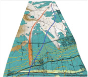
- Geographical Information Systems (GIS): We have extensive experience with various GIS systems and database techniques for the manipulation and analysis of large spatially-tagged datasets.
- GIS Data Management System (GDMS): We develop GDMSs in-house culminating in an innovative GIS-enabled data management tool providing a web-based portal for data collation and presentation at local, regional and national scales. As an example, the system can be used for asset management, enabling the monitoring of asset condition and informing maintenance schedules, whilst visualising data as part of an interactive digital map. The database can be accessed via the web, negating the need for GIS compatibility or specialist software investment.